The High Peaks Unit Management Plan
In effect April 1, 2000

As part of the Adirondack Park Agency Act and the 1972 State Land Master Plan (see the History section for more information on the Adirondack Park Agency), the Department of Environmental Conservation (DEC) is "directed to develop, in consultation with the agency, individual management plans for units of land classified in the master plan." The Five Ponds Wilderness and the St. Regis Canoe Area are two examples of "units" in this context; the Black River Wild Forest is another. Thirty years after the drafting of these unit management plans should have begun, only a small fraction of the units throughout the
Welcome to the High Peaks Wilderness Area
The sun sets on another day in the High Peaks Wilderness. This sign, welcoming
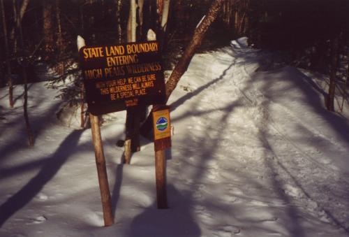
hikers to state lands, is located along the Calamity Brook trail, which connects
the Upper Works trailhead to the Flowed Land - Lake Colden region. The sign reads:
With your help we can be sure
this wilderness will always
be a special place
park have adopted such plans. It wasn't until the very end of the twentieth century that the most heavily used unit in the park, the High Peaks Wilderness (HPW), formulated its Unit Management Plan, called the HP-UMP or UMP for short. The drafting of this document, which exceeds 300 pages in its finalized form, has been years in the making. Jim Giglinto, Forest Ranger for the High Peaks, calls the UMP "long overdue."

The writing of the HP-UMP was not tax dollars wasted, however. The document is very in-depth, draws on volumes of research that has been done about the area, and discusses many of the issues currently facing the High Peaks, from overuse and erosion to acid rain and the introduction of non-native fish. Since a wilderness is defined as an area "which is protected and managed so as to preserve its natural condition," much of the focus in the document is on ways to relieve the stress caused by the thousands of hikers and campers who visit the region annually. From 1985 until 1995, the number of visitors to the state lands of the High Peaks doubled to 130,000. Thirty-five percent of these visitors entered through trailheads at Adirondack Loj, a lodge and campground owned and maintained by the Adirondack Mountain Club (ADK). Clearly, the trails in that region of the High Peaks receive a disproportionate amount of use. It is no wonder that the trail from Adirondack Loj to Marcy Dam has widened dramatically over past few years. The trail from the Loj to Mt. Marcy is the most popular route to the state's tallest peak, no doubt because it is the shortest by a mile a half. In some spots the region's trails have become so eroded that the path is several feet lower than the surrounding ground level.

Many efforts had been made previously to alleviate the pressure of tens of thousands of hikers' boots. The Summit Steward program, a joint venture by the Adirondack Mountain Club and the Nature Conservancy, began placing guides on the summit of several of the most popular High Peaks. These stewards have been informing the public of the fragility of the alpine vegetation on these peaks since 1989. From the program's inception until the mid-1990's, 83,000 people were contacted by the summit stewards, and the results have been noticeable. Together with re-seeding efforts on some of these peaks, the net alpine vegetation loss is, at worst, minimal. The Adirondack Mountain Club, Adirondack Trail Improvement Society (ATIS), and the DEC all maintain paid, professional trail crews in the High Peaks. Aside from clearing blowdown and other obstructions to trails (many trail crews responded quickly to the destruction left in the wake of Hurricane Floyd in 1999), these crews do heavy trail maintenance, such as building waterbars and stone staircases to stop erosion. Bog bridges, essentially hewn logs that provide a footpath to hikers in especially wet areas, not only keep hikers' boots dry, they only prevent damage to fragile wetlands. However, in spite of all these efforts, the funding, manpower, and time was just not enough to even keep up with the detrimental effects of increasing use. Enter the High Peaks Unit Management Plan. The writers of the document were charged with the difficult task of curbing the intense overuse while still maintaining, and in some cases enhancing, the public's enjoyment of visiting these lands. In some cases the HP-UMP simply tightens restrictions already in place. For example, previous regulations prohibited camping above 4,000 feet in elevation except from December 20 to April 19, reasoning that snowcover would protect fragile vegetation from damage. The UMP eliminates all camping over 4,000 feet, stating that "continued winter camping above 4,000 feet elevations atop thin, wind-blown snowpacks is an added stress on alpine environments." This is a listing of some of the more important new regulations enacted by the UMP. This is by no means a complete list. Will these restrictions help the state of affairs in the High Peaks, or is it too little too late? It is too early to say, but many are hopeful, including myself. Retired High Peaks Ranger Pete Fish says, "I think that many, many things are at work making things better now. Hopefully, with the Unit Management Plan in place, it is going to get better yet." Hopefully the public will not simply shun the new regulations in the hopes that they won't get caught by an under-staffed Department of Environmental Conservation; the Unit Management Plan was adopted to best serve the interests of both the public and the wilderness. Without the support of the public, the UMP cannot succeed. As the sign in the above photo states, With your help we can be sure this wilderness will always be a special place.

View the complete text of the High Peaks Unit Management Plan:
  • Plain text format, 689K
  • Plain text format, zipped (.zip), 219K
  • WordPerfect 6.1 format, 1443K (I have not tested the WordPerfect files, they may or may not work for you)
  • WordPerfect 6.1 format, zipped (.zip), 367K


    Go back to main Current Issues page.